Wagonwheel Lake and Copper Mountain

The “very steep” sign at the Wagonwheel Lake trailhead intrigued me last time I was at the Staircase ranger station in the Olympics. I heard the lake isn’t very impressive. I didn’t need to be impressed, but I did want to see some views of Sawtooth Ridge’s east side. Copper Mountain, beyond the lake and 1,300 feet higher, seemed like it would be a good vantage.

The trail to Wagonwheel Lake is very steep, as the sign promised. It switchbacks up a uniform slope for 2.9 miles and 3,200 feet to the lake. I bushwhacked around the south side of the lake on the way to Copper Mountain, and the north side on the way back. The south side was more open but steeper and slippery. The gentler north side features more slide alder and bountiful devil’s club in all the wrong places. Which is better? I think it’s a toss up.

The only other tracks in the snow beneath Copper Mountain were made by a bear glissading from the peak’s north ridge.

This trip down from the summit is the longest descent I’ve done without skis this year. I wasn’t too tired from the way up, but my legs sure got pounded on the way down.

IMG_6896

IMG_6897

IMG_6935

IMG_6907

Copper Mountain summit

Copper Mountain summit

Sawtooth Ridge

Sawtooth Ridge

IMG_6916

IMG_6919

IMG_6939


Posted in Uncategorized | Leave a comment

Juniper Peak: Where is everyone?

IMG_4253

I stood at the edge of the Goat Rocks Wilderness looking at an upright mammal 100 feet away. It appeared to be a large, half-naked woman with her wrinkly butt facing me. Or was it? I squinted, and thought maybe it was an equestrian in those tight tan pants they wear.

She stood between my and the parking lot. I had hiked 20 miles in the previous 24 hours, and I was eager to reach the food and other comforts waiting at my car.

A couple steps later I was certain the woman wasn’t an english-style equestrian. I backed around a corner behind some dusty thimbleberries and waited for her to leave, or at least put pants on. A couple minutes later when I rounded the bend again, the pantsless lady was nowhere in sight.

It was the afternoon on the third day of a four day road trip in the South Cascades. I had another day to hike, but I didn’t know where to go. Back at the parking lot, I consulted road and trail maps while flipping through guidebooks and various lists and notes I had made in preparation for the trip. The formerly naked woman and her hiking partner rested on a picnic table across the lot.

I impulsively picked a trail and drove off toward Juniper Peak in the Dark Divide roadless area. Forest Road 2904, on the way to the parking lot, was narrow and full of earthen speed bumps. The speed bumps should have been my first clue.

While coasting through a switchback, my engine died. I twisted my key in the ignition and the engine turned over, but it wouldn’t idle. Seconds later the dash lights flashed on and the engine vibrated off.

My car sat under a tree, rarely driven, for several years before I bought it. It didn’t idle well for the first month I owned it, but the problem gradually faded away. Now, more than a year later, it seemed to be back. I considered turning around, but the car ran fine if I constantly gave it gas. And if it did really die, I could probably coast all the way back to the highway, I thought. I revved the engine the rest of the way to the trailhead in fading daylight.

In my haste to pick a trail, I had chosen one that’s open to motorcycles. Skid marks and ruts ran back and forth between the two trailheads on either side of Forest Road 2904. Discarded cans of Miller Lite and camp fire remains decorated the bushes at the edge of the parking lot. I cringed at the thought of motorcycles blazing by on the trail the next day. Two-stroke exhaust, dust and roaring engines are features I try to avoid in hiking trails.

I got a slow start on the trail in the morning. The days of continuous hiking were beginning to wear on me. Knobby tire tracks covered every moist spot on the loamy trail. But the forest was big and lush.

IMG_3901

Three miles later, I hadn’t seen or heard a motorcycle. I hadn’t even seen a single human. It was a sunny Saturday and cars packed the lots at more popular trailheads nearby.

At the top of the climb on Juniper Peak, I looked out over the Dark Divide Roadless Area toward icy volcanoes. I felt like I had somehow cheated – I had a pristine place to myself on a mid-summer weekend. I was the luckiest hiker in Gifford Pinchot National Forest.

Legendary Northwest author Harvey Manning had this to say about the area: “The hiker with a bit of luck may meet wildlife – elk and mountain goats. Paradoxically, he may also find, thanks (no thanks) to motorcycles, solitude.”

IMG_4259

After reveling in solitude on the summit for half an hour, I heard the roar of a motorcycle. The sound slowly grew for 10 minutes, until two motorcycles emerged from the treeline far below on Juniper Ridge. I watched from above as the riders wheeled to a viewpoint. One rider yelled to the other through his full-face helmet, “Is this fucking cool or what?!”

It was fucking cool, I thought. Manning also said this in his description of Juniper Ridge: “Something there is in the spirit of a hiker that cannot abide machinery on the trail. When the wheels are let in, the feet fly out.” The riders headed south along the ridge and I went north down toward my car.

My car hummed to life, idling perfectly. But before I left, I flipped through my guidebooks to read about a couple other trails in motorcycle country.


Posted in Uncategorized | Leave a comment

Leftover photos part 3

IMG_5184Rocks south of Point of the Arches, Shi Shi Beach.

IMG_3988Sawtooth Ridge, Gifford Pinchot National Forest.

IMG_6320

Eldorado from Cascade Pass.


IMG_6304Corteo and Black Peaks from Maple Pass.

IMG_6611Mountain goat at Lake Ingalls.

IMG_5845Priest Lake, Idaho, from the Shedroof Divide trail in Washington.

Posted in Uncategorized | Leave a comment

Leftover photos part 2


IMG_4248The Palouse from Kamiak Butte County Park. I’m reminded of this Ed Abbey quote: “This is the most beautiful place on earth. There are many such places.”

IMG_2467More Palouse, this time from Iller Creek Conservation Area, just miles from downtown Spokane.

IMG_1122Basalt columns in Potholes Coulee.

IMG_5706Glaciers had a hand in shaping nearly everything in Washington. A finger of ice reaching down from Canada blocked rivers and streams on the westside of the rockies from draining into the Pacific. When the water got deep enough, it lifted the ice finger up and rushed westward. The water created the rolling Palouse hills the same way waves create ripples at the beach. Further north, the torrent gouged huge canyons and coulees like the one above – Potholes Coulee. In this photo, the White Glacier’s mass digs into Mount Olympus.

IMG_6011The Easton Glacier on Mount Baker.

IMG_3172I don’t have a dog. On occasion, I borrow one.


Posted in Uncategorized | Leave a comment

Leftover photos

I saw the layout of my book, Hiking Washington, last week and I’m really excited about it!

Here’s some photos that didn’t make it in:

Commonwealth Basin

Commonwealth Basin

Mount Rainier from High Rock

Mount Rainier from High Rock

Gifford Pinchot National Forest

Gifford Pinchot National Forest

Horseshoe Basin

Horseshoe Basin

Burned trees and fireweed, Iron Gate trailhead

Burned trees and fireweed, Iron Gate trailhead


Meadows on Alta Mountain

Meadows on Alta Mountain

Posted in Uncategorized | Leave a comment

Modern liftie: A season under the bullwheel

OLYMPUS DIGITAL CAMERA

“So you wrote a hiking guidebook, what’s next?” I asked myself. “Go to work at a publishing house in Manhattan? Guide the wealthy on outdoor excursions?”

Instead, I was accepted for a coveted artist-in-residence program at the Summit at Snoqualmie ski resort.* I could work on my writing as much as I wanted outside the hours that I worked as a lift operator and skied.

On my first Saturday of lift operations, I walked through the cafeteria, up a carpeted staircase and into Lift Operations headquarters for the inaugural safety meeting. Twenty other people filled the room – high schoolers, college students, recent graduates, people between careers, and burnouts. Unsure where I fit in, I stood against the wall.

Our captain wore a stained brown cap with an American flag on the front that was visible only when the fluorescent lights caught it just right. After the safety meeting, which consisted of our captain spitting gobs of tobacco into a plastic bottle while urging us to be professional, he sent us out onto the hill.

At Easy Street, a two-person chair going up the bunny slope, I soon learned that I wouldn’t be able to simply sit in the lift shack listening to Black Sabbath and writing poetry in exchange for my wages. Operating a bunny slope chair is serious!

The chair swings through the loading area every seven seconds. In that time, one must lift a pair of children onto a chair, make sure they’re seated properly, and keep one eye on them while trying to coax the next pair of children into the loading zone. If anything goes wrong, children can get hit by the steel chair. The guy training me made it look easy. He was closing in on a decade of lift operating and his technique was thoroughly refined. I admired his calm ease with guests and his ability to tell jokes that meant one thing to kids and something slightly lewder to their parents.

Most of the children who ride Easy Street are five to eight years old. My first day of work coincided with their first day of lessons, and many of them had never ridden a chairlift before. I lifted the shortest ones onto the padded seats. I asked the slightly taller children if they wanted help getting onto the chair. They often returned this query with an open mouth and a blank stare, or perhaps an unintelligible mumble, squeak, or other vocalization. I adopted the mantra “um means yes.”

Later in the day, I made my way to the top of the chair for an afternoon of helping the kids who forgot to unload in the appropriate spot – bullwheel riders, in industry parlance. Again and again, I stopped the chair as kids rode past the unload here signs and into the air. With their skis dangling three feet off the ground, they would often inform me that they forgot to get off.

After unloading and thanking the young bullwheel riders for riding my chair – as per Boyne Resorts policy – I returned to the lift shack and dutifully recorded the time, reason for stopping the chair, and the length of the stop on the lift log. Every stop must be recorded. The completed logs get hole-punched and put into binders in the break room where they remain in perpetuity, unless they are summoned to court.

A talented coworker crafted this piece

A talented coworker crafted this piece

I soon mastered the basics of stopping, starting and slowing down the chair. Next I concentrated on perfecting my ramp. I may have never mastered the arts of erecting the mazing at the bottom of the lift, greeting guests by name, or answering the phone within three rings. But I did become a ramp artiste. I quickly learned to fill in holes, scrape away mounds, and generally eradicate irregularities. Maintaining a ramp takes constant vigilance.

The days went on. Night’s after work, visions of miniature skiers shuffling forward into the loading zone percolated my dreaming mind. My feet stayed moist for months and my jokes got better.

The steady stream of skiers and snowboarders blurred together. I had the same interactions over and over, just with different people.

“Can you slow it down just a tiny bit. Like to 90 percent?” a timid skier would ask.

“Sure,” I responded with my finger hovering over – but not pressing – the slow button, which cuts the chairlift speed in half.

“Can you help me out with a boost?” The mother of a two-foot tall boy would ask.

“Of course. Is he going to need one too?” I’d respond.

And every once in a while a skier or snowboarder – usually an instructor – would tip me with a piece of candy, or a foul-smelling but appreciated energy drink.

Finding a balance between dehydration and an extreme need to pee is one aspect of chairlift operations that I never mastered. I began lunch breaks and ended my shifts by hustling to the long line of urinals in the lodge in a race against my bladder. After taking care of this most urgent need, I then turned my attention to my pulsing headache and dry lips by chugging water. But not too much, or I’d never make it through the afternoon.

At times, I resorted to scavenging the garbage can at the top shack for a bottle to pee in. I could only pull this off on quiet weekdays, and only after carefully weighing the chances of getting caught versus the possibility that I could hold it long enough to summon a relief lift operator, wait for them to arrive atop the chair, ride the chair to the bottom, and run to the long line of urinals.

My time as artist-in-residence was grueling. But it was made worthwhile by the hours I spent night skiing after work. I carved turns under the lights and rode lifts for free thanks to my complimentary season pass.

Will I further my career in Lift Operations and put in the four or five years required to become a Lift Supervisor? Well, I suspect I won’t have the chance to do so. At least not at the Summit at Snoqualmie.

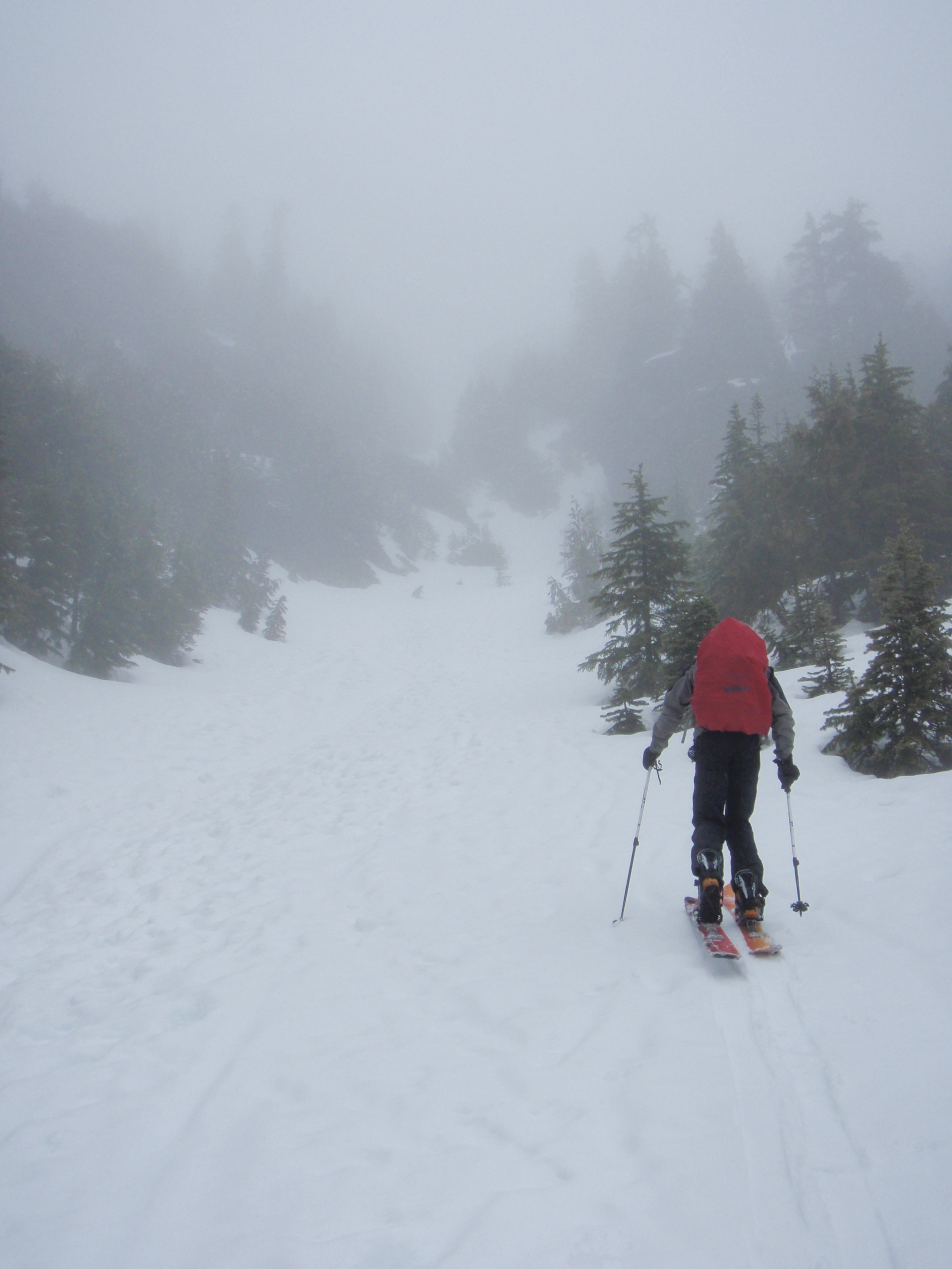
After artfully scheduling an overnight ski tour to Vesper Peak (detailed in a previous post) around my work schedule, I got a call from my boss. It was Thursday and he wanted to tell me that rather than working the following Saturday, Sunday, Monday, and Tuesday, as scheduled, I would be working just Wednesday and Thursday. I politely told him that I would not be working those days, for I already had plans to ski Vesper Peak. My friend Brett had even taken time off work to accommodate my work schedule.

My boss, correctly inferring that I had not grasped a basic tenet of employment, informed me that “You usually look at your work schedule and plan your activities around that. That’s typically how it works.”

I thanked him for the lesson and told him I still wouldn’t be able to work Wednesday or Thursday. He responded by telling me that he might not need me for the remaining weekends in April. After hanging up the phone, he voided my season pass, ending my tenure as a lift operator.

The timing couldn’t have been better. Night skiing at the Summit was closed for the season.

OLYMPUS DIGITAL CAMERA

Hundreds of mini skiers turning in formation down the slopes of East Street for the Powder Pigs year-end celebration


*The artist-in-residency bit is a fabrication. My tenure at the Summit at Snoqualmie did not include an actual place of residence. Or an artist-in-residence program.


Posted in Uncategorized | Leave a comment

April ski trips

Kendall Knob, March 31:

IMG_6275

On the last day of March I skied up Kendall Knob after work. For a goofy clearcut knob of a mountain, it’s a fun ski tour. I enjoyed views at the top of the clearcut before skinning back into the woods for a little more exploring. A lot of the old growth on the treed slopes adjacent to the clearcut are big and open. I carved turns and sprayed slush at ancient trees all the way to the car.

IMG_6289

By the time I got to my car, I was already running late to meet Craig and Brett to plan an overnight trip on April 2 and 3. After a lot of careful discussion we made a plan. The next morning we changed the plan. They day after that, we met at the Preston Park and Ride in the dark and took off for the Mountain Loop Highway and Vesper Peak.

Vesper Peak, April 2 and 3:

My wagon was the only car on the Mountain Loop Highway that morning. After finding a spot to park on the highway shoulder, we put on skis and started skinning up (and down) the Sunrise Mines Road. Two miles later we reached the trailhead, excited by the steep peaks and snowy, fluted faces all around us. We took off our skis just past the trailhead and continued over dirt and patchy snow until we crossed the South Fork Stillaguamish.

Craig crossing a slippery log in downhill boots

Craig crossing a slippery log in downhill boots

From there, we picked our way through steep slopes and thick trees toward the hanging valley. Huge avalanche debris filled the valley. A couple difficult stretches of chunky debris and awe at the scenery kept us entertained until we reached the base of Headlee Couloir.

The firm crust we skinned up so easily wasn’t firm enough to support us without skis on. We wallowed waist deep in the short couloir for more than an hour. I crawled on my knees, trying to maximize surface area on top of the snow. Our frustration melted away at Headlee Pass, where we stashed our overnight gear next to a gnarled snag and got our first look at Vesper Peak. We skied toward Vesper Peak after lunch. The snow got harder and harder as we climbed.

IMG_6394

Craig, thigh deep in Headlee Couloir


IMG_6406

All in all, the skiing was bad but the views were good. We made big turns down the open slopes, our metal edges scraping across icy snow. The views of the steep peaks, fluted faces, and narrow chutes surrounding us made up for the poor skiing. We had a blast cruising over the hard snow toward the deep valley.

Descending Vesper Peak. Del Camp and Gothic Peaks are in the background

Descending Vesper Peak. Del Camp and Gothic Peaks are in the background

Brett enjoying the view high on Vesper

Brett enjoying the view high on Vesper

At night from our scenic camp we watched stars appear above Vesper and Morning Star Peaks, and wondered whether anyone had visited their slopes before us this winter.IMG_6478

Otter Falls, April 7:

Warm weather and blue skies lasted for most of a week in early-mid April. I was busy but I got out for a hike to Otter Falls.

IMG_6597

Mount Ellinor, April 16:

Winter got a slow start in the Cascades, but the snowpack eventually caught up to average. The Olympic Mountains didn’t quite make it to average. At 3,000 feet on the road to Mount Ellinor we still hadn’t seen even a patch of snow on the side of the road through the rain drops on the windows.

I wanted to ski Mount Ellinor for a long time, and Brett agreed to come down and give it a shot. I was starting to feel bad about suggesting it because of the  lack of snow. We rounded a corner on FR 014 and got stopped by snow a couple hundred meters before the upper Mount Ellinor trailhead. We crossed the deep, but small patch of snow and started hiking. A half-mile later, we were still walking on dirt. We put our skis on where the winter climbing route leaves the summer trail. Ten minutes later, at the base of the Ellinor chute, we put our skis on our packs again.

A half-mile from the trailhead

A half-mile from the trailhead

Easy boot packing between walls of dark volcanic rock and twisted trees brought us to a false summit. We saw a faint outline of the summit wrapped in the cloud that surrounded us, and marched on.

Skinning toward the chute

Skinning toward the chute

OLYMPUS DIGITAL CAMERA


IMG_6606

After a quick lunch in the rain on the summit, we got ready to ski down. Skiing in the chute is fun. It’s alternated between narrow sections and miniature bowls. The biggest challenge was the foot-deep glissade track that cuts down the middle of the line. In narrow parts of the chute, we could only sideslip or jump-turn on one side of the glissade track or the other. The turns in the more open spots were worth the trip, even in the rain. It was our first time skiing in the Olympics!

Posted in Uncategorized | 1 Comment

Palouse Falls: Official state waterfall

Image

Palouse Falls is on it’s way to becoming Washington State’s official waterfall. The house unanimously passed a bill that would designate Palouse Falls as the state waterfall, and now it’s headed to the senate. So I gathered my photos of Palouse Falls.

It’s a very deserving waterfall. Anyone who is interested in waterfalls (or justice) may have noticed that it is usually missing from lists of best waterfalls in the state or the Pacific Northwest.

In some ways it reminds me of Snoqualmie Falls. At both falls, a boatload of water careens over one huge drop into a round plunge pool with vertical sides. By most rubrics, Palouse Falls is biggerthan Snoqualmie Falls. The surrounding landscape is dry, and relatively flat, making the volume of water and nearly 400-foot plunge all the more breathtaking. The whole watery scene is perfumed with the scent of sage and the awesome feeling of lonely, open space.

I didn’t pass any other cars on the dirt road between the highway and the falls, but I did come around a corner to find a lone cow trotting up the one-lane road. She slowed, stopped, faked left and then juked right around my wagon.

Image

Image

There’s not much hiking to do at Palouse Falls, but if you’re ever nearby it’s a mandatory stop. I hiked a mile or so upstream past the upper falls and into a narrow canyon above the falls. Downstream of the falls, I didn’t find much other than game trails and animal bones.

Image

Yellow-bellied marmots scurry around at the top of the mesa. If you startle them, they sprint toward the edge of the several-hundred-foot-tall cliffs and appear to huck themselves into the watery abyss. I thought I was responsible for the deaths of several marmots until I discovered they nest in the cliffs, and were just scampering back to their homes. Falcons and hawks also dwell in the cliffs and circle high above the plunge pool throughout the day.

Image

Posted in Uncategorized | Leave a comment

The Southeast corner: The beloved Blue Mountains

IMG_4486

“Do you get used to being alone on top a mountain for months?” I wondered aloud.

“It got easier after the first three years,” she said.

For eight summers she has lived on top of a mountain in the heart of the Blue Mountains.  Her bedroom/kitchen/living room is surrounded by air and sky on all four sides. In the time between short summer nights, she scans the horizon for smoke. Even as we talked she pointed out a weird cloud that she was keeping her eye on.

Before I arrived at the sun-baked shack on a high ridge, I didn’t know there were working fire lookouts left in Washington State. Now I was dreaming of becoming one myself. I thought I could handle being alone for so long if it meant waking up on a mountain top. And besides, this wasn’t just any mountain top. From the square wooden room balanced on top of the highest ridge in Washington’s lofty southeast corner you can see halfway across the state.

The immense views are why the Forest Service still hires a lookout at this spot in the Wenaha-Tucannon Wilderness. It’s one of just a handful of working fire lookouts left in the state, and it’s still there because it’s cost-effective. When it’s clear, you can see Mount Stuart, and even Umtanum and Manastash Ridges near Ellensburg. A short distance east were spectacular ranges I’d never even heard of, like the Seven Devils in Idaho – a wall of volcanic rock rising from the depths of Hell’s Canyon.

I could get used to this, I thought, as I surveyed the stash of tea, coffee, books, and house plants in the lookout shack, and the empty valleys and remote peaks on the horizon.

I wasn’t the only one intrigued by life atop the mountain. A camo-clad teenager and his mustached uncle who had just finished a three-night trek through the range were also on top of the mountain. The uncle and the fire lookout knew the Blues intimately, and they compared their favorite ridges, peaks, springs and loop trips.

The Blues are composed of porous basalt. The melting snow trickles into the rocky ridge tops, and eventually dribbles back to the surface in countless springs scattered throughout the blue mountains. Earlier that day, I passed the highest elevation spring in the Blues, at nearly 6,000 feet. It’s just a few hundred feet below the top of a long arcing ridge that runs from Oregon Butte to Diamond Peak. Despite it’s height, cold clear water still trickled out of the spring in late August of an especially dry summer.

Because of these springs, its possible to make multi-day trips in the Blues without hardly leaving the tops of the 6,000-foot-high ridges. If you spend enough time in the Blues, the fire lookout said, you’ll decide on which spring has the tastiest water. If you spend even more time there, you’ll have arguments about the best spring.

The fire lookout and the guy with the mustache argued about whether Oregon Butte spring or Panjab spring tasted best. Each acknowledged that the others favorite spring was pretty good, but they stuck with their separate choices.

I had spent months driving all over the state, and sampling the more popular trails in each area. Now, I wanted to explore one spot until I knew every drainage, peak, and spring, like these wizards of the Blue Mountains. Maybe I should become a fire lookout, I thought. Maybe I should move to Dayton and learn the long trails and game tracks that ramble for miles along the ridges in the Wenaha-Tucannon Wilderness.

I asked the lookout everything I could think to ask about life as a fire lookout. And that’s when she said it got easier after the first three summers. My dreams of drinking from every spring in the Blues dried up.

I stuck to the popular trails and shorter hikes in the Blues while researching my guidebook. I might not make the five-hour drive back to the Blue Mountains any time soon, and I’m probably not going to become a fire lookout either. But the locals and their love of the Blues did inspire me to explore more thoroughly the wild places around me.

IMG_4510


Posted in Uncategorized | 3 Comments

High Rock: A long three-mile hike.

IMG_3940

Purgatory must feel like driving on state Route 161 through Puyallup, South Hill, and Graham. Every time I worked my sticky gear stick up to fifth gear, a traffic light blinked into view. A tunnel of strip malls surrounds the straight road and the endless red lights that divide it. I could hardly see the clear cuts beyond the Vern Fonk insurance agencies, Jiffy Lube’s and storage units.

After successfully passing through this vision of purgatory, my beater Subaru hummed up a gravel road in the direction of gathering thunderheads. I was on my way to High Rock, just south of Mount Rainier National Park. High Rock is just what it sounds like. A high rock. And it has a cool view of Mount Rainier. It’s a short hike but I planned on spending a long time on it.

Sometimes I meet people who don’t like hiking. They think hikers like walking and exercise and nothing else. Maybe hiking is about walking and exercise for some people. For me it’s about the views.

My favorite hikes are long, but that’s only because I like to see a lot of views. I must admit, I do find satisfaction in being tired and pushing on until I finally get to camp or return to the parking lot hungry, tired and aching. My girlfriend says people of European descent feel the need to accomplish something, even on their days off. And I think she’s right.

Once on an overnight hike through an obscure patch of Central Washington wilderness, my friends and I picked ticks off our bodies, found animal carcasses, and even stepped on a few bull snakes. The terrain reminded P.J. of the hills surrounding a farm where he once worked on California’s Central Coast. He worked with mostly immigrants and some of them had hiked through the desert for days just to get to America. Thinking they would be interested in hiking, P.J. told them about his plans for a weekend backpacking trip. The immigrants thought it was weird that he hiked for fun.

Halfway up the 1.5-mile trail to High Rock, I lingered at timber line while lightning flashed every 10 minutes. After 40 minutes of crouching in the bushes, I continued up to High Rock, where I saw one of the best views of Mount Rainier I have ever seen. I got comfortable and stared at crevasses and rock faces, and I stared at the incredible difference in height between Mount Rainier and the foothills below it. Even the Tattoosh Range and the Goat Rocks Wilderness – which seem like grand mountains from most vantages – looked inconsequential and hardly worthy of having a name next to The Mountain.

At sunset I headed down. It was a four hour hike but I only walked for an hour.

Relief print of Mount Rainier

Relief print of Mount Rainier

Posted in Uncategorized | Leave a comment